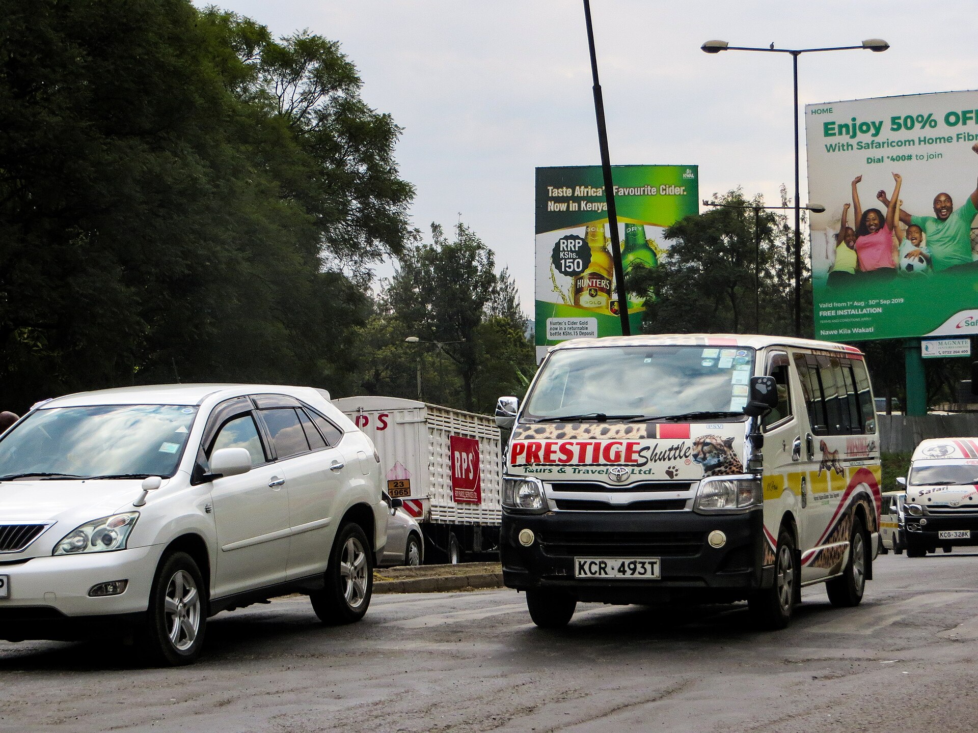
Photo: Victor Kibiwott / Wikimedia Commons, CC BY-SA 4.0
Listen to this article4 min listenAI voice
Tap play to hear this story
You are listening to Kibra News Network.
Getting out of Kibra: a commuter’s guide to matatus, the train and walking routes.
Kibra sits close to the middle of Nairobi and is still awkward to get out of. The settlement's internal lanes take no vehicles, the roads that ring it are congested for several hours a day, and the cheapest option is often the slowest. Here is how people actually move.
Matatu
Matatus serve Kibra from the Ngong Road side, the Lang'ata Road side and the Kibera Drive corridor, running into the city centre and out towards Lang'ata, Karen, Rongai and the western suburbs. Stages are informal and everyone knows where they are; ask, and you will be told.
Fares are not fixed. They rise in the morning and evening peaks, they rise when it rains, and they rise when fuel prices move. Budget for the peak fare and be pleasantly surprised. Carry small notes; conductors are chronically short of change and it costs you time.
The practical advice that regulars give: board at a stage rather than mid-route if you want a seat, keep your phone out of sight in a stationary jam, and if you are travelling after dark, use the busier stages.
The commuter train
The Nairobi commuter rail network runs services on the old line that passes along Kibera's northern edge, and for anyone whose journey matches the timetable it is the best value in the city: cheap, immune to road traffic, and predictable in a way the matatu is not.
The catch is frequency. Commuter services are built around morning and evening peaks, so if you miss the window you are back on the road. Check current timings before you rely on it, because schedules change.
Boda boda
Motorbikes are the only motorised transport that reaches into most of the settlement, and for short hops they are unbeatable. They are also where most of the ward's road injuries come from. Agree the fare before you sit down, insist on the helmet, and do not let a rider take you through a jam on the wrong side of traffic to save four minutes.
Walking
A large share of Kibra's working population walks to work, and for destinations along Ngong Road or towards Industrial Area that is a rational choice rather than a hardship. It is free, it is often faster than the same trip by matatu in peak, and the routes are busy enough to be reasonably safe in daylight.
Where it breaks down is rain. Several of the internal routes become impassable, and the railway path and river crossings are the first to go.
What would actually improve this
Lit, drained pedestrian routes out of the settlement would help more people than any new road. So would a bus rapid transit corridor that actually opened on the Ngong Road alignment, and a commuter rail service frequent enough to use off-peak.
In the meantime, the single most useful thing is information. If you know current fares, stage locations or train timings, send them to news@kibranewsnetwork.co.ke and we will keep a live version of this guide.
That was a Kibra News Network report, read by an A I voice.
Kibra sits close to the middle of Nairobi and is still awkward to get out of. The settlement’s internal lanes take no vehicles, the roads that ring it are congested for several hours a day, and the cheapest option is often the slowest. Here is how people actually move.
Matatu
Matatus serve Kibra from the Ngong Road side, the Lang’ata Road side and the Kibera Drive corridor, running into the city centre and out towards Lang’ata, Karen, Rongai and the western suburbs. Stages are informal and everyone knows where they are; ask, and you will be told.
Fares are not fixed. They rise in the morning and evening peaks, they rise when it rains, and they rise when fuel prices move. Budget for the peak fare and be pleasantly surprised. Carry small notes; conductors are chronically short of change and it costs you time.
The practical advice that regulars give: board at a stage rather than mid-route if you want a seat, keep your phone out of sight in a stationary jam, and if you are travelling after dark, use the busier stages.
The commuter train
The Nairobi commuter rail network runs services on the old line that passes along Kibera’s northern edge, and for anyone whose journey matches the timetable it is the best value in the city: cheap, immune to road traffic, and predictable in a way the matatu is not.
The catch is frequency. Commuter services are built around morning and evening peaks, so if you miss the window you are back on the road. Check current timings before you rely on it, because schedules change.
Boda boda
Motorbikes are the only motorised transport that reaches into most of the settlement, and for short hops they are unbeatable. They are also where most of the ward’s road injuries come from. Agree the fare before you sit down, insist on the helmet, and do not let a rider take you through a jam on the wrong side of traffic to save four minutes.
Walking
A large share of Kibra’s working population walks to work, and for destinations along Ngong Road or towards Industrial Area that is a rational choice rather than a hardship. It is free, it is often faster than the same trip by matatu in peak, and the routes are busy enough to be reasonably safe in daylight.
Where it breaks down is rain. Several of the internal routes become impassable, and the railway path and river crossings are the first to go.
What would actually improve this
Lit, drained pedestrian routes out of the settlement would help more people than any new road. So would a bus rapid transit corridor that actually opened on the Ngong Road alignment, and a commuter rail service frequent enough to use off-peak.
In the meantime, the single most useful thing is information. If you know current fares, stage locations or train timings, send them to news@kibranewsnetwork.co.ke and we will keep a live version of this guide.
KNN Newsroom is the staff byline for stories written, rewritten and edited at the Kibra News Network desk. Where a story credits an outside outlet, the original source is linked at the foot of the piece.