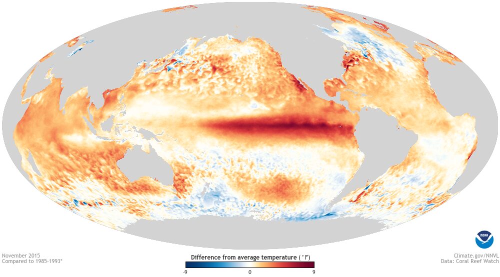
Sea surface temperature anomalies during the 2015 El Niño (file). Photo: NOAA via Wikimedia Commons (Public domain)
Listen to this article2 min listenAI voice
Tap play to hear this story
You are listening to Kibra News Network.
WMO says this El Nino could be strongest in decades.
The World Meteorological Organization (WMO) said on 3 September that the current El Nino could grow more intense than any event recorded in its four decades of monitoring, and is nearly certain to persist through February 2027.
"If this trajectory continues, it may be stronger than anything since our monitoring began, so literally off the charts we have used for the past four decades," said WMO chief Celeste Saulo, speaking at a press conference in Geneva.
Widespread disruption forecast
The WMO's outlook for September to November points to above-normal temperatures across nearly all land areas, drought risk in the Amazon, Indonesia and Australia, and disrupted monsoon rains over India. Rainfall patterns are expected to shift across the wider tropics as the event strengthens.
The agency urged disaster management authorities and climate-sensitive sectors, including agriculture, healthcare, energy and water utilities, to begin preparing immediately, saying there is "no time to lose." Kenya's own forecasts already point to above-normal short rains from October, which is why the Kenya Red Cross and Nairobi County have begun flood preparations.
This story was put together by K N N from material first published by Al Jazeera.
That was a Kibra News Network report, read by an A I voice.
The World Meteorological Organization (WMO) said on 3 September that the current El Nino could grow more intense than any event recorded in its four decades of monitoring, and is nearly certain to persist through February 2027.
“If this trajectory continues, it may be stronger than anything since our monitoring began, so literally off the charts we have used for the past four decades,” said WMO chief Celeste Saulo, speaking at a press conference in Geneva.
Widespread disruption forecast
The WMO’s outlook for September to November points to above-normal temperatures across nearly all land areas, drought risk in the Amazon, Indonesia and Australia, and disrupted monsoon rains over India. Rainfall patterns are expected to shift across the wider tropics as the event strengthens.
The agency urged disaster management authorities and climate-sensitive sectors, including agriculture, healthcare, energy and water utilities, to begin preparing immediately, saying there is “no time to lose.” Kenya’s own forecasts already point to above-normal short rains from October, which is why the Kenya Red Cross and Nairobi County have begun flood preparations.
KNN Newsroom is the staff byline for stories written, rewritten and edited at the Kibra News Network desk. Where a story credits an outside outlet, the original source is linked at the foot of the piece.